EO AFRICA R&D Facility Online Course
Satellite remote sensing of air quality
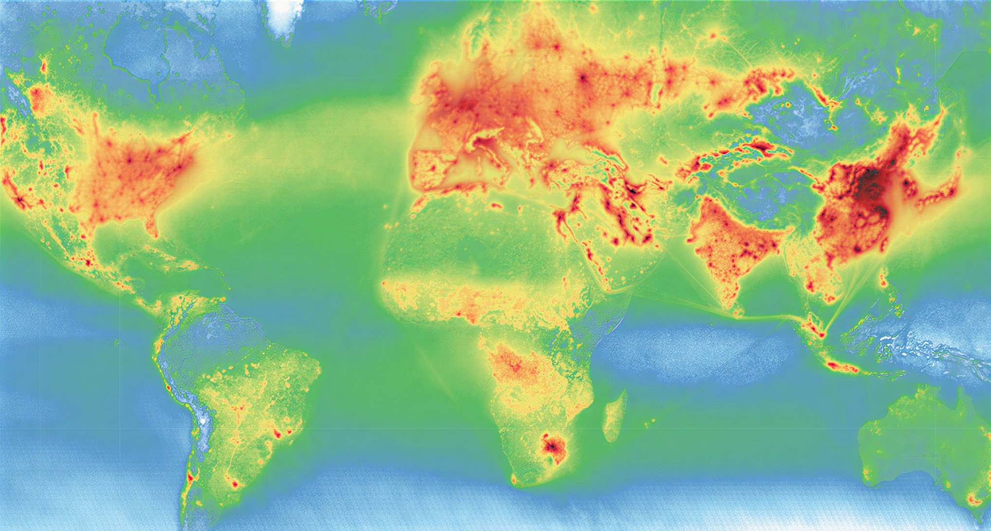
Global map of nitrogen dioxide (NO2), from TROPOMI measurements 2020-2021. The short-lived trace gas NO2 is a byproduct of fossil fuel combustion and fires.
Introduction to the course
The atmosphere is the most variable part of the Earth System and the first layer that solar radiation encounters. Changes to the Earth System – due to natural variations, human actions or climate change, often leave their signature in the atmosphere. The topic of this course is Atmospheric composition, processing and applications. Within this course, you will learn how the interaction between radiation and atmosphere can be exploited to derive the atmospheric composition. The course focuses on detection of the composition of the lower atmosphere from space: methods, data, tools and applications.
Reading materials alternate with videos, tutorials and thought-provoking questions. The participants will have the opportunity to test their understanding in quizzes and apply the acquired knowledge by completing practical exercises.
Upon completion of this online training course, the participant will be able to:
- Explain the basic interactions of radiation with the atmosphere: absorption and scattering
- Explain how the concentration of trace gases and greenhouse gases can be inferred by using absorption spectroscopy
- Explain how visible radiances observed by satellite instruments are used to characterize aerosols and clouds
- Find and work with TROPOMI data using python scripts
- Analyze temporal and spatial patterns of air quality data using python and jupyter notebooks
- Review a case study involving atmospheric composition data
Mode of Delivery
The course consists of videos, PowerPoints, quizzes, and practical exercises, supplemented by reading material and reference materials. All materials will be offered through the Moodle learning platform. Participants are expected to go through training materials independently (i.e., no live teaching is foreseen). Interaction with the teaching staff will be possible through a series of dedicated live feedback sessions (hosted through MS Teams) and a Q&A forum. A certificate of completion will be issued to participants who completed the course, including the three quizzes embedded in the course.
Prerequisites
The participants are expected to have a basic knowledge of the Earth System, Earth Observation principles and some affinity with programming. Before the start of the course participants will be given access to an online course of the EOAFRICA RDF series (OC 1: Cloud Computing and algorithms for EO analyses), which we advise to go through for refreshing the knowledge on basic principles of EO and tools/algorithms.
Selection
The course will be offered to a maximum of 75 participants. Selection will be based on relevant academic background and employment. Only applicants working for an African-based organization are eligible. We will strive to have a gender-balanced and country-balanced group of participants. Preference is given to candidates working as (Ph.D.-) researchers, post-doc, and university staff. Selection will be made two weeks before the course starts. Participants are expected to notify their employer or institution about commitment to this online course.
Teacher
-
Expert of air quality remote sensing – Faculty ITC of the University of Twente
https://people.utwente.nl/m.j.m.penningdevries
m.j.m.penningdevries@utwente.nl
Timeline
Total Course duration will be 40 hours (estimated 10 hours per week for 4 weeks).
Five live sessions (60 min each) with teachers will be organised on:
- Monday, May 25, 10:00 (CEST) – Live introduction to the course
- Friday, May 29, 14:00 (CEST) – Q&A session: Week 1
- Friday, June 5, 14:00 (CEST) – Q&A session: Week 2
- Friday, June 12, 14:00 (CEST) – Q&A session: Week 3
- Friday, June 19, 14:00 (CEST) – Q&A session: Week 4
- (All Central European Summer Time – CEST which is UTC +2)