
Crop and Rangeland Monitoring from Space
The 19th F2F course of the EO AFRICA R&D Facility will take place in Harare, Zimbabwe, between October 20th – 24rd, in close collaboration with University of Zimbabwe and linked to the 30th African Association of Remote Sensing of the Environment (AARSE 2026) conference. This course is designed to introduce participants to relevant Earth Observation datasets, tools and analysis techniques in the context of cropland and rangeland monitoring.
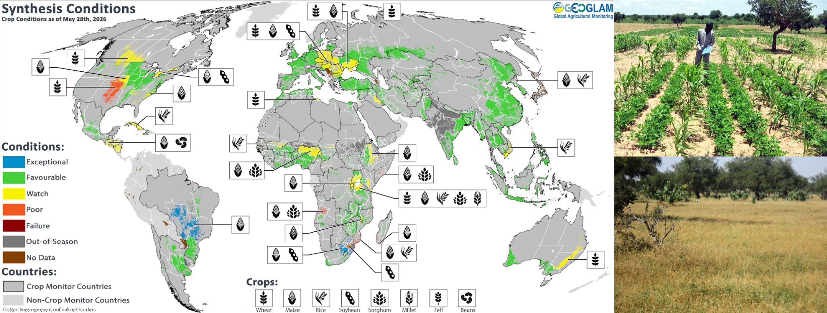
Image Credit: (left) GEOGLAM CropMonitor; (right – crops) Charles Wortmann; (right – grassland) Abdourahamane Zakari, AGRHYMET.
The course is organised in 5 days filled with theoretical lectures ensuring sufficient understanding of the conceptual background and hands-on exercises performed in a cloud-computing environment to gain the required technical skills on data manipulation and interpretation. Focus will be on free and open source satellite data and derived products, particularly from the Copernicus program. Specific topics include agricultural drought monitoring, rangeland carrying capacity, crop (type) mapping and crop yield estimation. Participants will be challenged to think about applying these concepts and skills to their own use cases.
Upon completion of this course, participants will:
- Be aware of both the advantages and limitations of open-source satellite EO data for the purpose of cropland and rangeland monitoring.
- Know how to select, access and use the right open-access data and tools for applications related to crop- and rangeland monitoring.
- Be able to gain insights into agricultural droughts using low resolution satellite data (1 km).
- Estimate the carrying capacity of rangelands through EO-based Dry Matter Productivity products.
- Derive cropland and crop type masks using 10m resolution satellite data.
- Gain an understanding on how satellite data can be leveraged for crop yield estimation.
- Have practiced the use of open-source software and cloud computing for image processing.
Each day of the workshop will consist of a morning and afternoon session with a total duration of 6 hours. Participants will be asked to shortly present their group assignment during the last day of the training.
ABOUT THE COURSE
CAN I APPLY?
Who can participate?
Space is limited to a maximum of 25 participants. Participants will be selected based on their academic background, work experience and motivation to participate. We will strive to have a gender-balanced and country-balanced group of participants. You will receive a confirmation e-mail about selection results and further information by September 2026.
Participants should reside in one of the African countries, should have an academic background related to Geoinformation/Earth Observation Science in combination with knowledge on Environmental Sciences, Forestry, Agriculture, Geography, or similar. Prior experience in Python programming and the use of cloud environments will be an asset but not a requirement. Young researchers in the field of agricultural monitoring are encouraged to apply!
Teachers:
-

Assistant Professor – Department of Natural Resources, Faculty ITC of the University of Twente
https://people.utwente.nl/m.t.marshall
m.t.marshall@utwente.nl -

R&D Professional – Agricultural Applications, VITO Remote Sensing
https://remotesensing.vito.be/team/jeroen-degerickx
jeroen.degerickx@vito.be
Registration:
Schedule
Each day of the course will consist of a morning and afternoon session with a total duration of 6 hours. Each session will combine lectures, practical exercises and discussions. Participants will be asked to shortly present their group assignment during the last day of the training. The project will be developed under supervision of the trainers.
- Morning session: 9:00 – 13:00 (including coffee break).
- Lunch break: 13:00 – 14:00.
- Afternoon session: 14:00 – 16:00.
Certificate of Attendance
Participants who have been actively participating during the course and present their own project will be given a Certificate of Attendance issued by the EO AFRICA R&D Facility and University of Zimbabwe.
Technical requirements
Participants are requested to bring their own laptop with GIS software pre-installed (QGIS or ArcGIS). Access to the Innovation Lab (EOAFRICA’s cloud computing facility) will be granted prior to the course. In addition, participants are required to register for a free account on the following platforms that will be used throughout the course:
- Copernicus Data Space Ecosystem: https://dataspace.copernicus.eu/
- VITO’s Terrascope platform: https://terrascope.be/en
It is advised that the participants get themselves acquainted with the free online courses on “Cloud Computing and Algorithms for EO Analyses” and “Principles and Advances in Earth Observation” of the EO AFRICA R&D Space Academy. Access to these online courses will be provided upon acceptance into the face-to-face training.
Cost and Sponsorship
Attendance to the training course is free of charge.
Participants will need to arrange and pay for their own travel, subsistence and accommodation. Lunch and coffee/tea break will be provided during the workshop. For those not living in Harare, the Facility can sponsor for a limited number of participants up to EUR 200 to cover such expenses. Should you want to apply for this funding, please indicate it in the application form. Payment – upon proof of expenditures – of the 200 Euro (max) will go via bank transfer and will be arranged after completion of the workshop.