EO AFRICA R&D Facility Online Course
Vegetation and Drought Monitoring from Space

Introduction to the course
Today, droughts present one of the most severe threats to global food security. Due to climate change, the frequency, intensity and hence impacts of droughs are rapidly and continuously changing worldwide. In order to adapt our agricultural practices to these changing conditions, we first of all need access to efficient tools that help us visualize and understand these dynamics at various spatial scales.
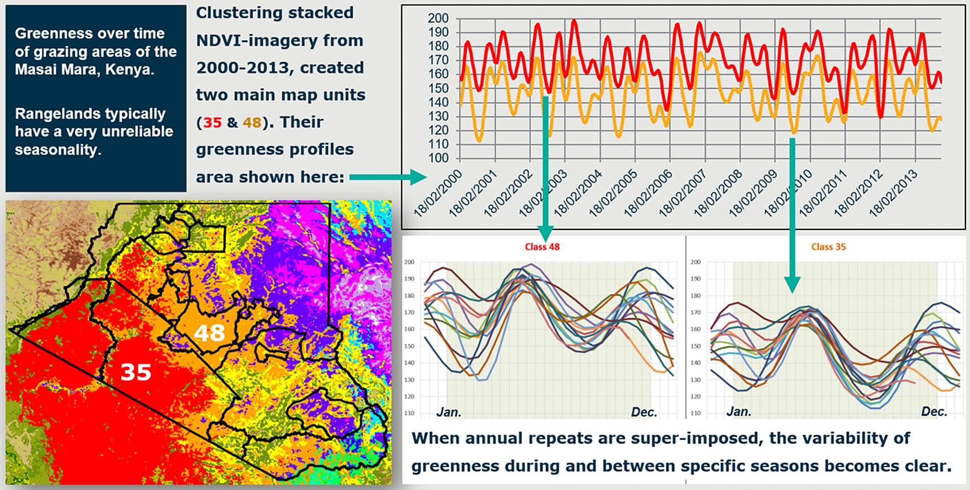
This online course will provide participants with the necessary theoretical and practical knowledge on vegetation and drought monitoring based on satellite EO data. It will introduce the general concept of EO-based vegetation/drought monitoring, show the different types of potentially useful EO data, highlight relevant satellite sensors and freely available data products as well as explain different analysis techniques that can be employed for deriving meaningful information from satellite observations. Participants will learn how to select, access and use the right data and tools for their specific application related to vegetation and/or drought monitoring. In particular, we will zoom in on the use of EO data for regional to local assessments of vegetation productivity, the impact of droughts on vegetation productivity, crop damage and rangeland dynamics.
Prerequisites
Having attended the online course on Cloud Computing and Algorithms for EO Analyses would be beneficial, but is not a strict prerequisite.
Selection
The course will be offered to a maximum of 65 participants. Selection will be based on relevant academic background and employment. We will strive to have a gender-balanced and country-balanced group of participants. Preference is given to candidates working as (Ph.D.-) researchers, post-doc, and university staff.
Registration:
Speakers:
-

R&D Professional – Agricultural Applications, VITO Remote Sensing
https://remotesensing.vito.be/team/jeroen-degerickx
jeroen.degerickx@vito.be -

Associate Professor – Department of Natural Resources, Faculty ITC of the University of Twente
https://people.utwente.nl/c.a.j.m.debie
c.a.j.m.debie@utwente.nl -

Assistant Professor – Department of Natural Resources, Faculty ITC of the University of Twente
https://people.utwente.nl/m.t.marshall
m.t.marshall@utwente.nl
